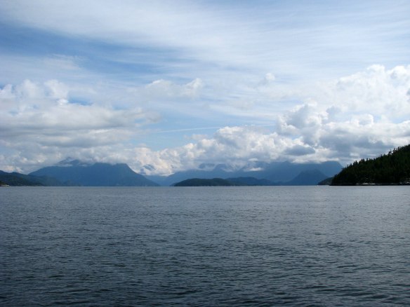
When we entered Desolation Sound in 2004, we had this spectacular view of the B. C. mainland mountains that lie behind the waters of Desolation Sound. Sarah Point is on the right.
Getting to Desolation Sound is always a “feel-good” event for us. We’ve cruised in and through Desolation Sound numerous times since our first cruise there in 1980. Each time, we look forward to the spectacular views of snow-capped mountains as we enter the waters there.
Desolation Sound Marine Provincial Park has been described as “a boater’s paradise at the confluence of Malaspina Inlet and Homfray Channel.” There are spectacular views, calm waters, and safe anchorages. It includes several islands, numerous small bays and snug coves. The tidal currents flow around Vancouver Island and meet at Desolation Sound, keeping the water warm enough for swimming. It’s a great place to explore and relax.
The trip north from Pender Harbour on the Sunshine Coast takes us a little over 6 hours, and the trip from Comox on the Vancouver Island side takes about 5 hours. Since there aren’t many good anchorages to stop in along the way, we usually travel the full distance in one day. So it always feels good to reach Desolation Sound.

We also had fairly clear skies when we entered Desolation Sound in 2001. Sarah Point is on the right.

In 2009, we had partly cloudy skies when we entered Desolation Sound. We could see the mountains, but the tops were hidden by the clouds.
This year we weren’t so lucky with the weather, and we arrived under overcast skies with low-hanging clouds that obscured the tops of the mountains. We know how beautiful it can be on a clear day, so we were disappointed that we missed that view. However, just BEING in Desolation Sound feels good.
We’ve been asked what it’s like to cruise along at 7-8 knots in our trawler, so we filmed a short video as we entered Desolation Sound from Malaspina Strait in June, 2013. Join us on a brief video tour as we enter Desolation Sound!
This video was taken looking east toward mainland B. C., just after we passed Sarah Point. It shows Sarah Point at the far right, than pans through some of the islands of Desolation Sound and finishes pointing toward Cortes Island and the route to continue further north to the Squirrel Cove anchorage and beyond.

