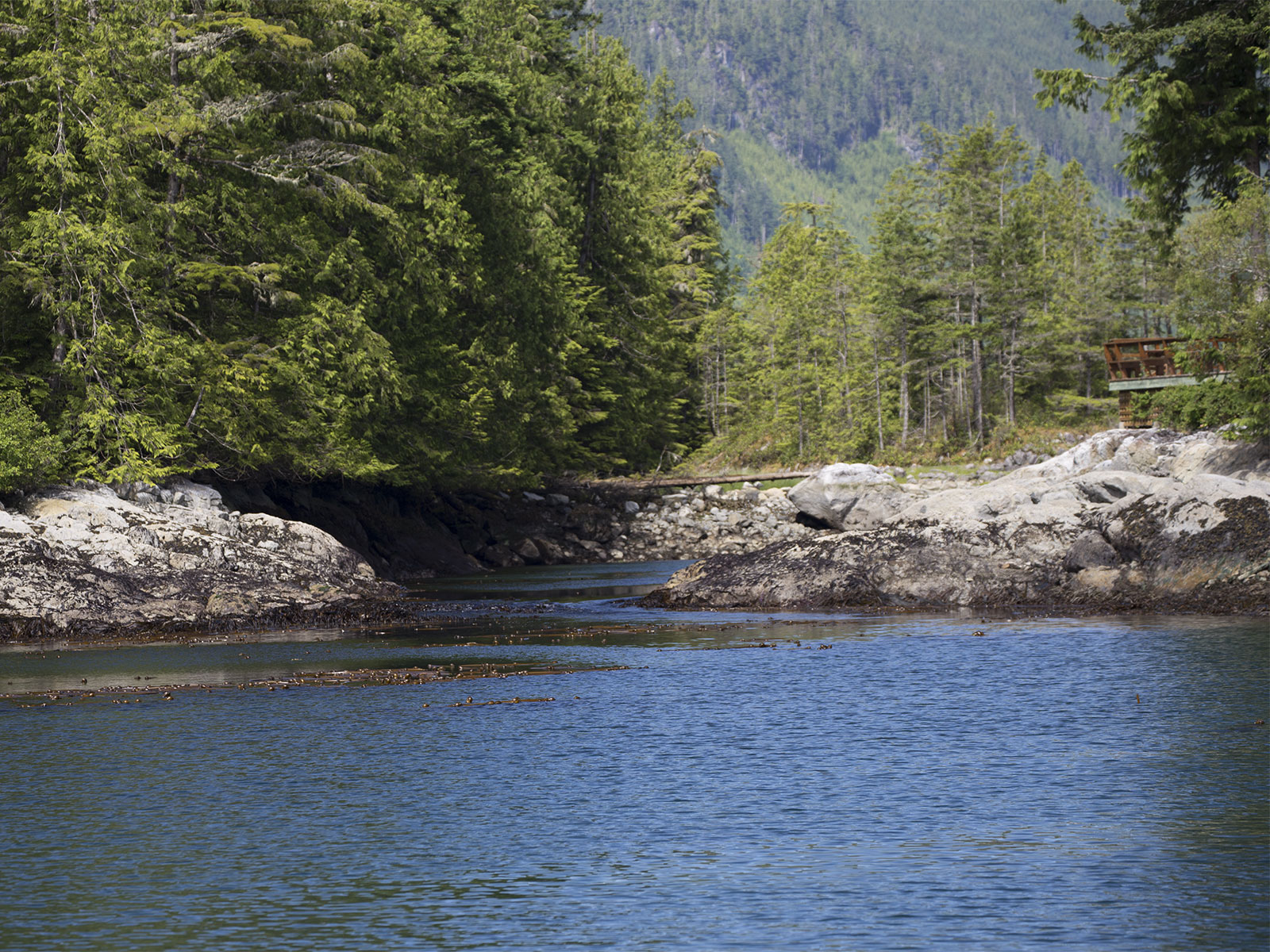
Canoe Pass is a narrow passage that flows alongside Dent Island Lodge. I took this photo at slack water from our boat shortly after we arrived. At slack water, the current is calm and the sea is flat. The side deck of the lodge is visible at the right in the photo, and offers a great place to watch the current ebb and flood.
The Inside Passage is famous for big tides and fast currents. As the water floods and ebbs from the Pacific Ocean, it is constricted when it forces its way through narrow passages, called tidal rapids. There are many tidal rapids all along the Inside Passage. When we were at Dent Island, we had a chance to watch the tidal rapids in Canoe Pass from the shoreline and see how the water changed throughout the day as the currents changed direction.
Canoe Pass is a small channel that flows right next to Dent Island Lodge. It is not part of the main navigation route through the Inside Passage, but it is a good example of how dramatically the water changes in a tidal rapids as the currents ebb and flood.

About an hour after slack water, the flood current has started to build. You can see the water starting to rise and the current gaining strength.

Later that afternoon, as we walked around Dent Island Lodge, I took this photo of Canoe Pass Rapids from the lodge’s deck. This was taken around the time of maximum flood.
The best way to understand the force of the current at maximum flood is to see it in action and listen to the roar of the current. This short video shows the current flowing alongside the lodge and out to the docks where our boat is tied up.
Tidal rapids occur in narrow areas where there’s a restriction and lots of water needs to get through in a hurry. When the rapids are flowing at maximum flood or ebb, there can be overfalls of several feet and strong whirlpools that can swamp a small boat. To pass safely, you need to know what time of day the slack water occurs. At slack water, the current is changing from flood to ebb or vice versa and the water is calm for a few minutes as the current shifts direction. If you arrive at the right time, you might feel a little push and pull from eddies, but the overall experience should feel controlled.
The tides rise and fall from the pull of the moon as the earth rotates. As the tide changes, it creates currents that flow into and out of the Pacific Ocean. In this part of the world, there are typically four tides each day, approximately 6 hours apart—two high tides and two low tides. And there are typically four currents each day—two ebbs (a low water ebb and a high water ebb) and two floods (a low water flood and a high water flood).
Around Dent Island, there are three rapids that must be navigated to transit the Inside Passage: Yuculta, Gillard, and Dent. It takes careful planning to time the transit of all three of these rapids at or near slack water. The currents here are strong—they are downright dangerous at or near their maximums—and they are strongest when the moon is full. There was a full moon when we were there, and the predicted velocity of maximum flood in Gillard Rapids was 12.5 knots with a maximum ebb of 9 knots. Needless to say, we paid careful attention to getting through the rapids at slack water!
When we plan our routes, we look at the current tables to see what the current is doing for the area we plan to cruise. We study the currents to see how strong they are, which way they are flowing, and how they interact with the wind and tide. This helps to determine how long it should take us to reach our destination and, more importantly, helps us to arrive at tidal rapids around slack water. Currents are always a factor, but become much more critical when we need to transit tidal rapids.
We use a tidal reference called Ports and Passes. It has an easy-to-read format and covers the entire cruising areas of Washington and British Columbia. NOAA publishes the official current and tide tables for U. S. waters, and the Canadian Hydrographic Service publishes similar information for British Columbia. Tide and current predictions are also available in electronic format from several sources.

Wow, great post😎. I really enjoy your Indepth reporting.
Thanks, Marilyn. We’ve learned a lot about the force of nature in cruising through the rapids in the Inside Passage, and it’s fun to share!