Kwatsi Bay to Claydon Bay

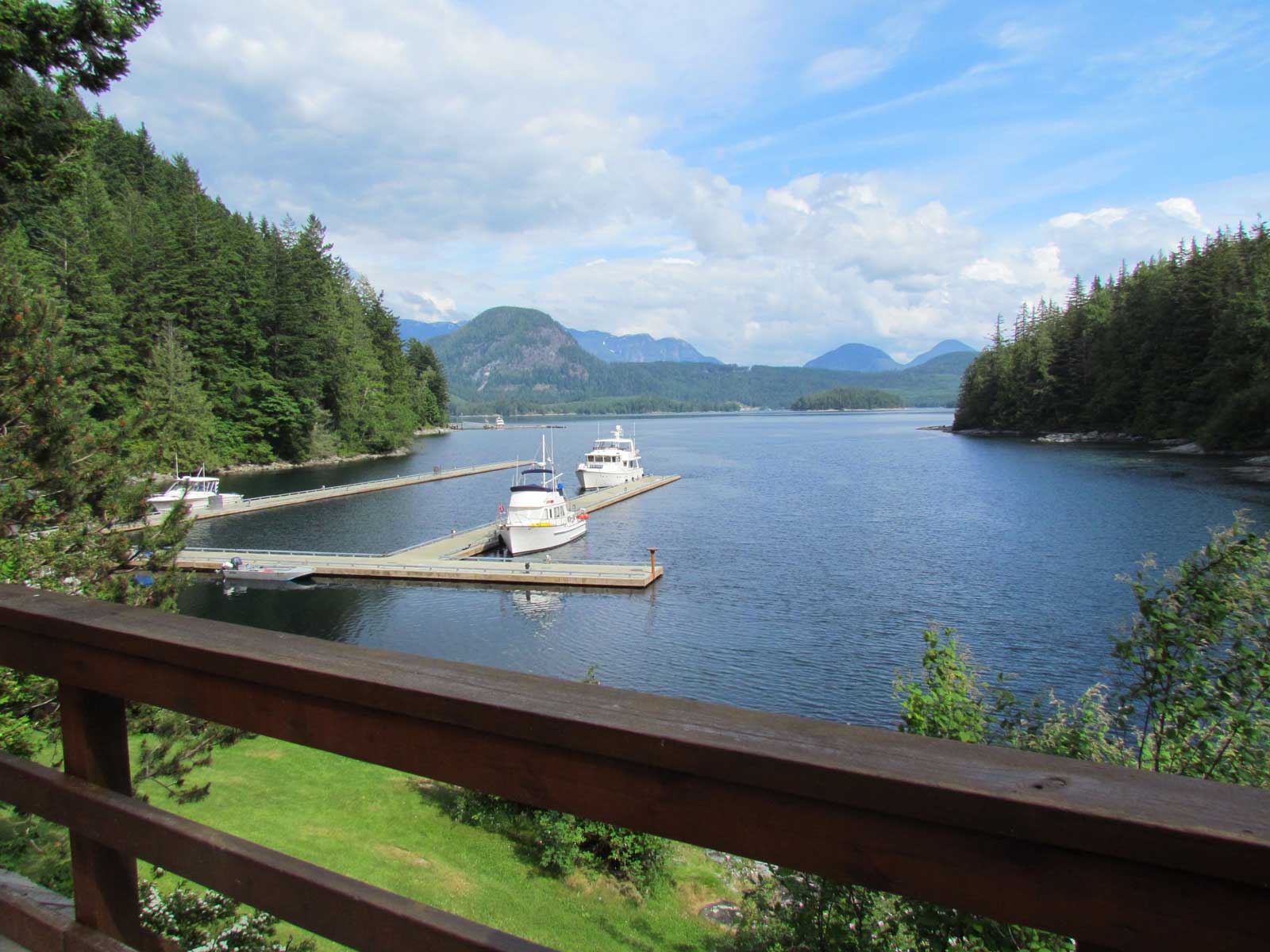
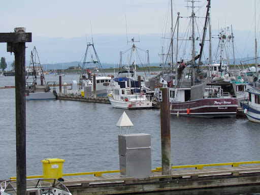
June 17 – Kwatsi Bay Marina

Couldn’t make up our minds this morning about whether to move on or to stay another day in Kwatsi Bay so that Jim could finish the work on installing the Internet router. So, we decided to flip a coin. Heads, we leave; tails, we stay. First flip was tails, so we decided to make it 2 out of 3, and it was tails again. To be sure, we flipped again, for 3 out of 5, and it was tails a third time. So, we stayed!
It was sunny and calm this morning. So nice for a change. Jim finished mounting the router in the forward hanging locker while I baked some treats for tonight’s happy hour. I found a recipe for baking flour tortilla wedges with melted butter and cinnamon and sugar on top…VERY tasty. All the sailboats from last night left this morning, and have been replaced by 5 more boats. So the dock is full again tonight.
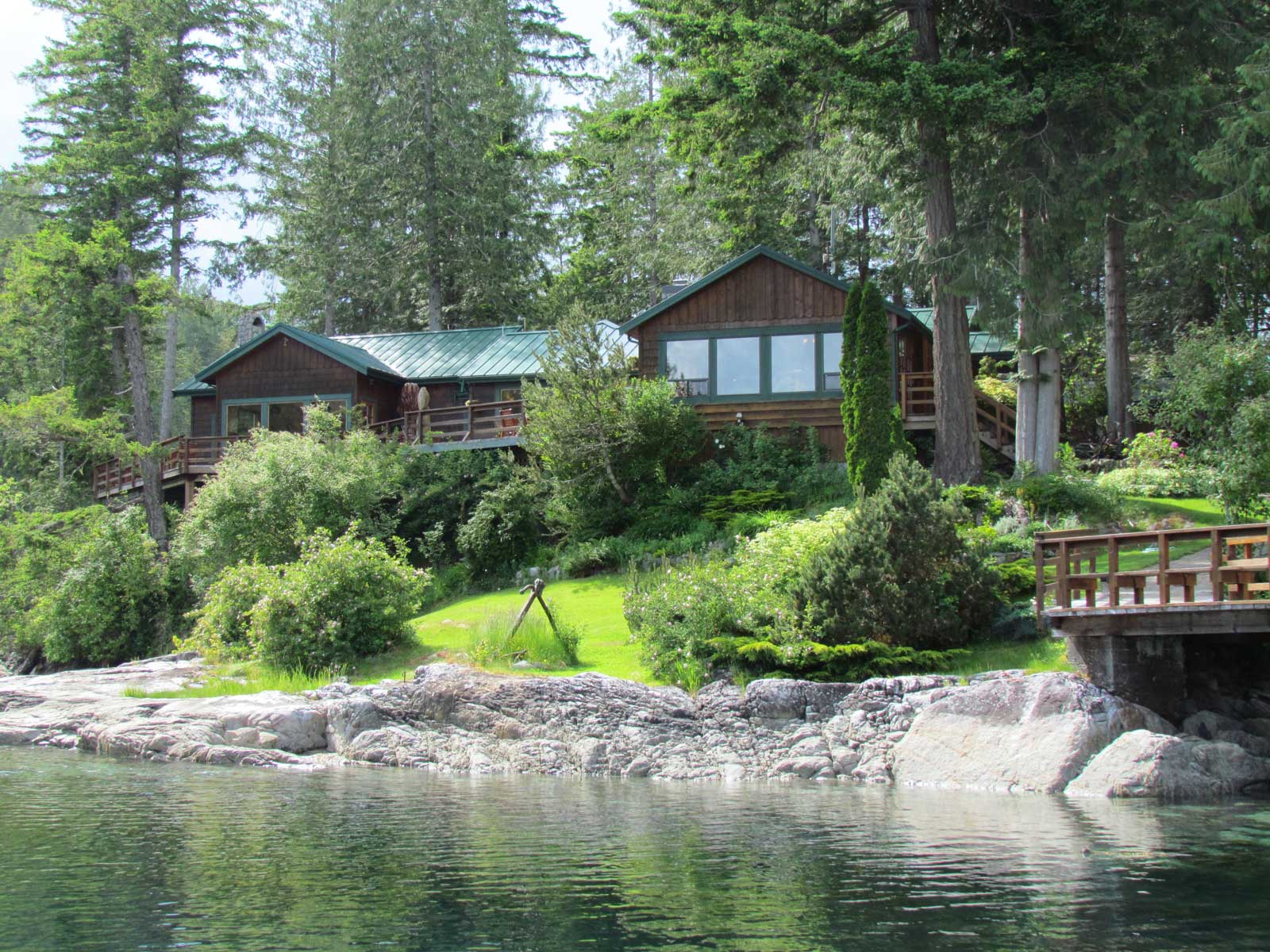
One of the benefits of staying another day is that Max went over to Port McNeill this morning to bring Anca and Russell home for the weekend, so we had a chance to catch up with Anca and look over the additional things she added to the store. We bought a book called “Totem Poles and Tea,” written by a woman who was a nurse in Mamalilaculla (now a deserted Indian village) in the 1930s. Looks to be a good story about life in the Broughton Islands a long time ago, and will be a nice addition to our boat library.

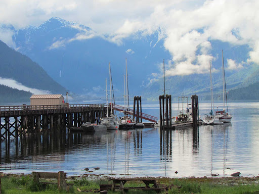
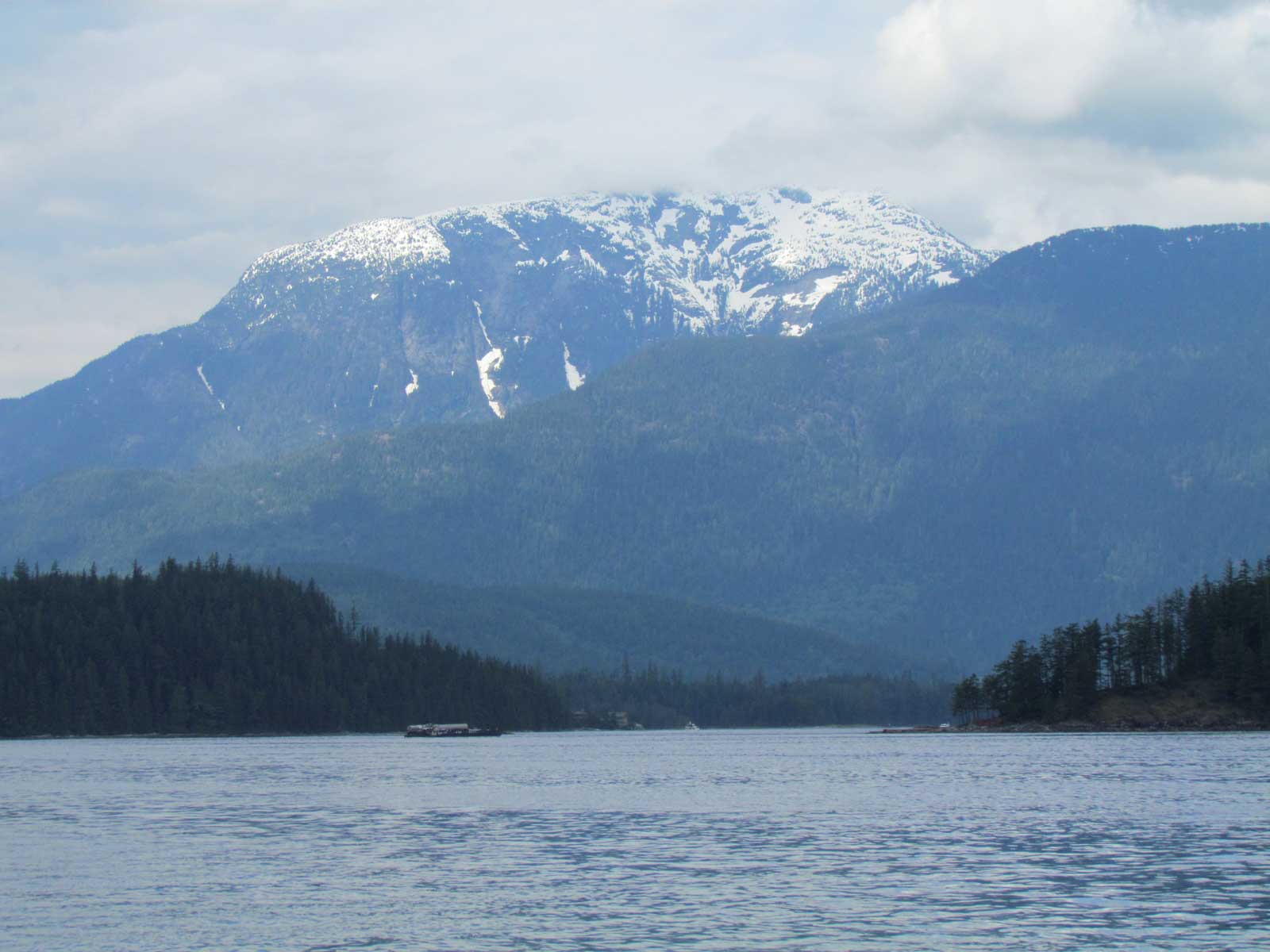
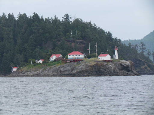
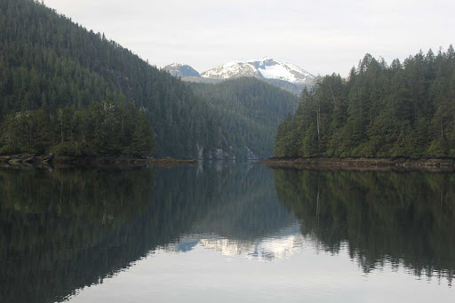
In the early morning calm, the snow-capped Mt. Read
towers above the entrance to Kwatsi Bay Marina
@font-face { font-family: “MS 明朝”; }@font-face { font-family: “Cambria Math”; }@font-face { font-family: “Cambria”; }p.MsoNormal, li.MsoNormal, div.MsoNormal { margin: 0in 0in 0.0001pt; font-size: 12pt; font-family: Cambria; }.MsoChpDefault { font-size: 10pt; font-family: Cambria; }.MsoPapDefault { margin-bottom: 10pt; }div.WordSection1 { page: WordSection1; }
June 18 – Claydon Bay
Kwatsi Bay to Claydon Bay, 27.59 nautical miles
Total this trip to date: 280.57 NM
It rained hard all night and into the morning at Kwatsi Bay. Everything was SOAKED! Visibility was reduced by the rain and accompanying fog. Fortunately the rain slowed down and the fog lifted to about 150 feet as the morning wore on, so we felt okay about leaving.
The Internet was not available this morning due to volume. Kwatsi Bay Marina offers WiFi service, but there is a usage limit, and once the limit is reached, the server is down for 24 hours. So that’s what we experienced this morning. Guess there were a lot of people using the Internet yesterday.
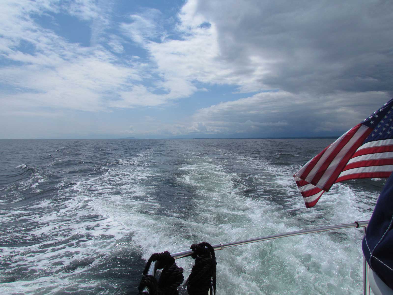
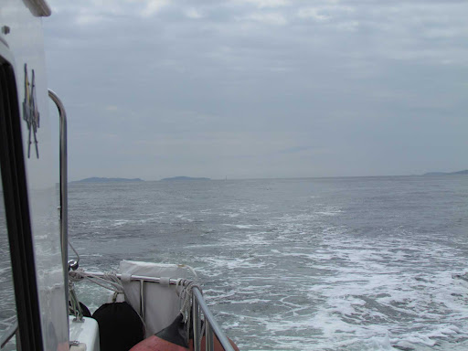
We left Kwatsi Bay around 1100, and all the other boats at the dock left within minutes of each other. However, we encountered a boat on its way in as we left, so the dock won’t be empty very long. We topped up our water tank, and chatted with Anca in the store as she checked us out. Russell and Max helped us get away from the dock, and we made our way north in Tribune Channel. It was rather rough motoring into a 15-knot northwest wind, but the chop was reduced as we left Tribune Channel and entered Penphrase Passage. From there on, it was an easy passage. Mickey and Rosie are getting more comfortable with the motion and noise, and they moved around more in the cabin today while we were underway.
As we approached Claydon Bay, we encountered numerous floats from crab pots, and they looked like commercial floats. What a surprise to find even more floats in the Claydon Bay anchorage! There was only one boat here when we arrived, but they hoisted their anchor and left shortly after we anchored, and we have the entire anchorage to ourselves. In past years, we have usually seen, on average, about 8 or more boats anchored in Claydon Bay. Don’t know if it’s because of the crab pot floats or just not many people coming this way today. It’s still early in the season.
We are anchored in about 30 feet at mid-tide, with good mud holding and lots of room to swing. Still cloudy, but at least it’s not raining. Expected to put out our crab pot here, but there are way too many commercial pots already covering the area.
We left Kwatsi Bay Marina at low tide
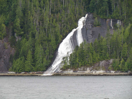
One of the many waterfalls in Tribune Channel
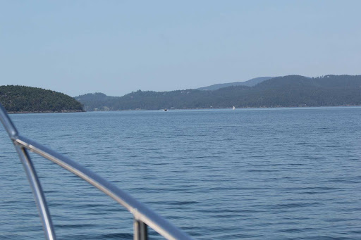
Heading north in Penphrase Passage, it was still cloudy
with fog hanging in the trees…but lighter sky ahead!
We encounter lots of floating logs from logging activity
in the area. This is an entire floating tree!
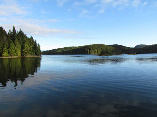
We had a gorgeous evening at Claydon Bay

Shoal Bay to Kwatsi Bay

June 14 – Matilpi
Shoal Bay to Matilpi, in the Broughton Islands, 39.88 nautical miles
Total this trip to date: 227.66 NM
This morning at Shoal Bay we had our choice of leaving to catch the early slacks or leisurely leaving in the afternoon to do the afternoon slacks. The current was with us in the morning, so we decided to catch the morning slacks, and pulled out of Shoal Bay at 0715. It was really cold this morning (44°) and we certainly are glad we have a good diesel heater! We planned to either stop and anchor in Forward Harbor, or if the weather was good, to go all the way to the Broughtons.

We encountered more whirlpools in Green Point Rapids than we remember from past trips. The way to get through this area where there are two rapids to transit and no good place to stop in between, is to go through Green Point Rapids about an hour early and Whirlpool Rapids about an hour late. We were lucky this morning and, other than the whirlpools as we left Green Point behind, we were just about on time for Whirlpool Rapids and had a very easy time transiting them.
As we left Whirlpool Rapids, rather than turning in to Forward Harbor, we decided to take advantage of what appeared to be a relatively calm Johnstone Strait, and headed out Sunderlund Channel. The Straits were good to us, and about two hours later, we turned off Johnstone Strait at the Broken Group and headed down Havannah Channel.
We usually proceed directly through Chatham Channel, but today it was flowing about 6 knots against us about the time we wanted to go through. So, we decided to stop before the channel and tried a new anchorage. We turned in to Matilpi, an anchorage between the mainland and a small Indian Island. It is marked by a lovely shell beach and is written up in our reference books as a quiet anchorage with good holding and protection from most winds. Two fish boats came in after we anchored and rafted together behind us.
Still raining today, with high temps around 58 and a few sunbreaks (very few!). We hope this weather will improve soon!

Heading north in Cordero Channel, approaching Mayne Passage
Entering Johnstone Strait, very good conditions
Rosie looking out into the rain and
contemplating our anchorage at Matilpi
White shell beach at Matilpi
June 15 and 16 – Kwatsi Bay Marina
Matilpi to Kwatsi Bay, 25.32 nautical miles
Total this trip to date: 252.98 NM
June 15
Early this morning, we watched the tide go out at our anchorage at Matilpi. Low tide was around 8 AM, and the water dropped 14 feet from the high tide yesterday when we anchored. It is a small anchorage, and we found ourselves VERY close to the shore, but our depth sounders still showed over 30 feet. Got us going early!
We left to catch the slack current in Chatham Channel, which was less than two miles away. Easy transit, as we carefully watched the range markers. As we exited the channel, we entered Knight Inlet and found ourselves motoring into a 15 knot NW wind that was kicking up a few waves. As we turned to enter Tribune Channel, we took advantage of the cell phone coverage in that area to call Kwatsi Bay Marina to make sure we could find moorage.
Tribune Channel is a gorgeous fjord, lined with majestic snow-capped mountains. It is one of our favorite places. It was disappointing today, however, because the cloud cover hid the tops of the mountains. Still a nice ride though.
As we entered Kwatsi Bay, the mountains shielded us from the wind, and the water became calm. We found only two other boats here. Max, the marina owner, greeted us and told us where to side tie. Anca and Russell are in Port McNeill this week. Max told us about a lot of weather damage they sustained this past winter. It’s been a long, hard winter all over the west coast, and BC is no exception.
Max arranged a happy hour at 5 PM and the crews from Phoenix, Safari, and Easy Goin’ gathered and told sea stories. The sun actually came out in the evening and we can almost see the top of Mt. Read, the snow-capped mountain just west of Kwatsi Bay.
June 16
We decided to stay a second day at Kwatsi Bay to catch our breath and so that Jim could work on our Internet router. We’ve had it for a while and have been using it propped up on a settee (which has been a bit of a nuisance), so this is a nice quiet place where we can take care of mounting it to a bulkhead in a forward cabin hanging locker.
Alice had some time this afternoon to bake bread, so we got out the bread machine and it just produced a fresh loaf of light whole-wheat bread. Smells wonderful! Today has also been a good opportunity to clean up the boat…both inside and outside.
The sun actually broke through the clouds for a while this afternoon and we saw the thermometer hit 70…but it feels a little cooler in the wind. Some fog this morning, but otherwise quiet here at the dock.
Max is planning a potluck on the dock at 6 PM. Easy Goin’ left this morning, leaving Phoenix and Safari at the dock. This afternoon, an American Tug and five sailboats have arrived. So far there are eight boats at the dock  for tonight.

Matilpi at low tide
Entering Tribune Channel, Alice on the bow adjusting
our Hawaii Yacht Club burgee
Magnificent Tribune Channel with clouds hiding
the tops of the snow-capped mountains
The dock and store at Kwatsi Bay Marina
The top of Mt. Read (across from the entrance
to Kwatsi Bay) finally came out of the clouds
Jim running cables in the main cabin to locate the
Internet router in the forward cabin

Dent Island to Shoal Bay

June 13 – Shoal Bay

Dent Island to Shoal Bay, 9.18 nautical miles
Total this trip to date: 187.78 NM
Started the day with continental breakfast at Dent Island Lodge. Had to wait until the afternoon slack at Dent Rapids before we could continue, so we read and did odd jobs around the boat until shortly after 1500 when we left. It rained hard all night and continued to rain on and off (mostly on) all day. We thought it was drying out an hour or so before we were going to leave so we wiped down the boat…however by the time we left, the rain had started again.
It was raining hard as we transited Dent Rapids and we were monitoring our course by radar. Thought that we must have taken a wrong turn and were in Alaska! Thankfully the fog cleared as we approached Shoal Bay. No other boats there, so we side-tied on the west side of the dock, looking out Phillips Arm to the snow-capped mountains of mainland BC, still shrouded in clouds, but spectacular none the less. It rained some more as we tied up, but finally cleared by 1900 so we were able to walk up to the pub and talk to Mark MacDonald (the owner). He is in the process of building a new house, further back on the property. He said he’d rather separate his living quarters from the pub, which sounds like a good idea to us.
Three more boats came in after us, so there are now a total of four.
There is WiFi here, but it doesn’t reach our boat, so we need to take our laptop to the pub in order to get a good signal. The shed where he previously had recycling bins has been torn down.
From here we will make our way to the Broughtons via Johnstone Strait, and don’t expect to have access to Wi-Fi for several days.
Dent Island Lodge, set up for breakfast
Cordero Channel, shrouded in rain and fog
Shoal Bay boardwalk leads to pub and grounds
Dock at Shoal Bay overlooks Phillips Arm
and the mountains of mainland B.C.

Comox to Dent Island

June 10 – Squirrel Cove, Cortes Island, Desolation Sound

Comox to Squirrel Cove, 34.8 nautical miles
Total this trip to date: 157.36 NM
We did find some good fish and chips last night…went to the Blackfin Pub, a short walk from the marina, and enjoyed a rather nice dinner. We also bought some prawns from a local fish boat…they were asking $5 a pound, and even though we hope to get some of our own as we get further north, we couldn’t resist. They were so fresh that a few were still kicking!
We started our day at Comox by taking our laptop to the marina manager’s office when it opened at 0900. I worked on some banking business while Jim walked up to the Blue Heron Bookstore to buy Canadian Chart #3527, Baynes Sound, which provides more detail about this area, especially for crossing the bar to get back out to Georgia Strait. We have all the BC electronic charts, but always feel better to have the actual paper chart that covers where we are, and since we’ve never been in this area before, we didn’t have this detailed chart.
We left Comox at 1000 under sunny skies and a 10-15 knot NW wind. Waves were 1-2 feet, with a few breaking, as we made our way across the bar and turned toward Cortes Island in Desolation Sound. We pounded for a while, taking a bit of saltwater over the bow, but the conditions improved as we got into deeper water and it became an easy trip the rest of the way to Desolation Sound. We anchored in Squirrel Cove about 1500. As the day progressed, clouds from the west overtook the sun, and we even had some light rain around 1900. Didn’t last long, however. Nice and quiet in the anchorage…only a dozen or so boats here. A good night to watch some DVDs.
Tomorrow Jim plans to tackle replacing the engine starter, so we’ll plan to stay a second night in Squirrel Cove.
Georgia Strait – looking south, clouds coming in from the west
Following a fish boat into Desolation Sound
We passed the Squirrel Cove store on our way to the anchorage
June 11 Squirrel Cove
Layover day
We spent a second night in Squirrel Cove so that Jim would have today to replace our engine starter. The job took 3 to 4 hours, with most of the time just getting wiring and other stuff out of the way and getting the bolts out that held the old starter in place. Thankfully the replacement starter works and Jim was able to finish the work today. The old starter will come back to Anacortes with us to be refurbished and become our new spare. Our thanks to Whatcom Electric for their technical assistance on the phone.
It was sunny and a little breezy all day. All but one other boat left the anchorage, and only two more came it. Very quiet, which is nice. We saw a few eagles early this morning and a couple of loons swimming nearby, but no baby geese this time.
We plan to head further north tomorrow.
Spare engine starter in its box
In the engine room…the old starter before being replaced
Squirrel Cove anchorage
A pair of loons, swimming near our boat
June 12 – Dent Island
Squirrel Cove to Dent Island, 21.24 nautical miles
Total this trip to date: 178.6 NM
We left Squirrel Cove in the sun, but it became cloudy as the day progressed. We decided to go through the slack around 1500 at the rapids, so didn’t leave Squirrel Cove until after 1100, allowing plenty of time to deal with potential unfavorable currents and so we could take our time. This trip we found the current running with us in Lewis Channel, and we were WAY early for the slack at Yuculta and Gillard. So we ended up idling and even drifting for a while…along with several other boats also waiting to transit the rapids. In previous years, we have been confused about the currents in Lewis Channel, as they always seemed to run opposite of the predictions. Based on what we observed today, it appears that the current in Lewis Channel DOES run opposite of the predicted current in the other main channels in the area.
There was only one other boat at the dock at Dent Island when we arrived, and only one other boat came in. It is early in the season and places are still relatively slow.
Dinner at the lodge was wonderful, as usual. We had our choice of several appetizers and main courses. For appetizers, Jim had seared scallops over risotto, and I had spot prawns over a mixture of wild rice and sliced apple. For dinner, Jim had the crab (a WHOLE crab) and I had salmon. Both meals were served with a selection of local vegetables. We found room for a bit of dessert…Jim had crème brulee and I had a chocolate volcano cake with a scoop of vanilla ice cream. Certainly a meal to remember.
This is certainly not roughing it! But it is a great way to celebrate our 38th wedding anniversary. Back to cruising tomorrow.
Heading into Yuculta Rapids
Dent Island Lodge
Library at Dent Island Lodge
Phoenix and a Selene from Portland at the Dent Island docks

Nanaimo to Comox

June 9 Comox

Nanaimo to Comox, 52.66 nautical miles
Total this trip to date: 122.56 NM
Got an early start (0630) from Nanaimo. Winds were calm, but it was overcast. We planned to cross Georgia Strait to Pender Harbour. Well….
First, our engine starter just clicked at us, when it was expected to start the engine. After repeated attempts, it finally started…we have a spare starter, but wanted to get someplace (like Pender Harbour) where we had access to Internet, mechanics, place to stay awhile, etc. in order to troubleshoot the starter problem.
Then, when we started out from Departure Bay, we were motoring into 2-3 foot southeast swells. Rather uncomfortable, but we continued, thinking it would get better when we got further away from the shore. In addition, Area Whiskey Gulf was active today, including some special maneuvers of dropping flares or something like that from helicopters over Texada Island. Didn’t sound too inviting.
Once we turned toward Ballenas, it continued to be uncomfortable as we were now rolling in 2-3 foot following seas. It wasn’t very windy, just lumpy, and very gloomy overcast. By the time we reached Ballenas, our kitties were huddled up wondering what in the world was going on! Us too! When we passed Ballenas Island and turned toward Texada, the boat was rolling miserably and many things began rattling around in the cupboards. That was enough, and we turned to go with the seas, and changed our destination to Comox.
So, rather than the planned 30-mile day, we had a 50-mile day. Everyone was pretty tired by the time we got to Comox. We’re side-tied on F dock, with a bunch of fish boats. We walked around the town for a bit, and now are back at the boat where Jim can start working on the starter and we can get this update posted to our blog. We found the wi-fi access here isn’t to the computer on our boat, rather we have to take the computer to the office….or have line of sight to their antenna (we’d have to take the computer out on the dock in order to do that). At least we can get wi-fi!
Next, we are going to go looking for some good fish and chips!
A gloomy Georgia Strait – Looking back at Ballenas Island
Rosie, helping with navigation
Mickey, less than happy with the rolling
Chrome Island Lighthouse
Phoenix side-tied on F Dock at Comox

Anacortes to Nanaimo

June 6 Prevost Harbor

Anacortes to Prevost Harbor, 27.68 nautical miles

We are anchored in Prevost Harbor on Stuart Island tonight. We had a 4-1/2 hour run from Anacortes. Winds were variable 10-15, sometimes calm.  We rode the ebb tide out Guemes Channel, and made a direct trip across Rosario Strait and through the Islands to Prevost Harbor. We anchored in 25 feet at low tide. We found that the current frequently opposed the wind, resulting in the boat riding around the anchor and the chain grumbling as it got pulled along the bottom. The harbor breeze died down at sunset and it became flat calm. There are a few small boats at the park’s dock, only 2 boats tied to the park’s mooring buoys, and about a half dozen boats at anchor. Very quiet!

Rosie & Mickey slept most of the way, as they learn about boat noises and motion. Fortunately for us they both seem to handle boat travel fairly well.
Dinner tonight was barbecued Copper River salmon, barbecued corn-on-the-cob, and the rest of the Pugliese bread. The new barbecue works well, but we discovered there is a bit of a learning curve as it works slightly differently than our old one.
 Entering Thatcher Pass from Rosario Strait
Trawler transiting Pole Pass
Anchorage at Prevost Harbor
June 7 Montague Harbour
Prevost to Montague, 16.83 nautical miles
Total this trip to date: 44.51 NM
We woke today to a cloudy and gloomy morning. We had a short run in the rain from Prevost to Montague. We stopped at Montague to clear Canadian Customs, thinking we’d continue on. However, the reports of strong winds at Entrance Island plus it was too late to make the afternoon Dodd Narrows slack…so, we decided to anchor and spend the night at a very quiet Montague Harbour.
Motoring into some chop this morning was a little more stressful for the kitties, so they’re glad to stop here. The rain stopped mid-afternoon, and the winds turned calm. Making it a very peaceful stop. Baked banana bread in the afternoon while Jim worked on his ham antenna. Missed seeing the bread boat!
 We encountered this container ship in Boundary Pass
when we left Prevost Harbor
In Montague, this coot took flight as we startled him.
A rather empty anchorage at Montague.
This mega yacht came in, anchored for a couple
of hours, then left.
Another wonderful sunset at Montague
June 8 Nanaimo
Montague to Nanaimo, 25.39 nautical miles
Total this trip to date: 69.9 NM
We woke early to a calm, sunny morning. Got the anchor up and were underway by 6:45 AM to catch the slack at Dodd Narrows. Very calm all the way north in Trincomali Channel, and easy trip through the narrows…not much boat traffic this early in the day and in the year.
There were hardly any boats at Port of Nanaimo, so we had no problem getting a berth for the night. Spent the afternoon shopping for beer, wine, groceries, etc. Sunny and a gentle SE breeze most of the afternoon. Considered dinner at Penny’s Palapa, but ran out of time putting things away, so that we can be prepared to leave early in the morning if the weather is good.
Looking back at a calm Trincomali Channel in the early morning
Dodd Narrows
Entering Nanaimo Harbor, we saw this oil rig
being towed by 4 tugs into the harbor…
…and this is the ship that brought the oil rig to Nanaimo.
p.s. we don’t think there’s any oil in Nanaimo…
Phoenix tied up at Port of Nanaimo
Nanaimo Harbor